Traditional Cache Sor-Mandal-Knuden by Matthias, Tonje og Bjarne. Adopted by Rutter (3/1) Found it Found it Found it Found it Found it
Code: GC842A N58° 05.779  E7° 38.210 (WGS84) UTM  32V   E 419644  N 6440245
Size: Regular Regular    Hidden on 25-8-2002 In Vest-Agder, Norway   

Available in winter.
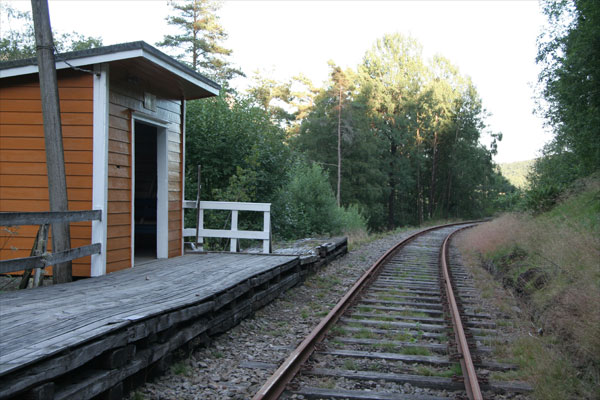
Nice for kids, Good place to rest before Kristiansand

This is a nice place to rest befor Kristiansand, and the boat to Denmark. It is quiet, and 200m from the main road. Knuden was built in 1922 and is a 356 degree turn made for climbing with car's or horces. This is a "must see" when driving from Mandal to Kristiansand.

Additional hints: It's a small plastic box, placed aprox 1m from the top, neraly right under where the fence starts, it's in a hole in the the wall. And it's totaly hidden. You must put in your hand to feel it.
GSAK Note 2009-04-20 by GSAK
Het
is
een kleine plastic doos geplaatst aprox 1m vanaf de top, neraly rechts beneden waar het hek begint,
is
het in een gat in de muur.

And it's totaly hidden.
En het
is
geheel verborgen.
You must put in your hand to feel it.
(Decrypted Hints)
Moet je in je hand te voelen.
Traditional Cache Sor-Lyngdal-#1 by Dr_Eamy (1,5/1) Found it Found it Found it Didn't find it Found it
Code: GCH26D N58° 08.993  E7° 09.375 (WGS84) UTM  32V   E 391481  N 6446881
Size: Regular Regular    Hidden on 13-10-2003 In Vest-Agder, Norway   

Nice old Stonebridge that go over a creek 100meters from E39-road This bridge is from the old days when horse’s wagon was used, and it was the main rode between Lyngdal and Vigeland. It is built from stones, piled up in a nice archway.
The creek that runs under it has a lot of small trout, kids younger than 14 can fish for free.

Additional hints: It’s hidden in a small hole on the right side, when you look upstream. Blue box.
GSAK Note 2009-04-20 by GSAK
Het is verborgen in een klein gat aan de rechterkant, als je kijkt stroomopwaarts.
Blue box.
(Decrypted Hints)
Blauwe vak.
in een nis in de stenen
Traditional Cache GEES#7 Flekkefjordbanen by Svirre (2/2) Found it Found it Found it Found it Found it
Code: GCXBA5 N58° 21.104  E6° 38.649 (WGS84) UTM  32V   E 362133  N 6470284
Size: Small Small    Hidden on 25-7-2006 In Vest-Agder, Norway   

Flekkefjordbanen er navnet på jernbanestrekningen fra Sira til Flekkefjord. Banestrekningen er 17 km lang med 13 tunneler.

Bygging av jernbane fra Flekkefjord til Egersund ble påbegynt i 1897 og 1. oktober 1904 gikk det første ordinære toget. Denne nye strekningen ble således en forlengelse av Jærbanen. Fra 1944 ble Flekkefjordbanen bare et sidespor til Sørlandsbanen som går fra Stavanger via Kristiansand til Oslo. I 1990 ble Flekkefjordbanen nedlagt. Den brukes nå kun av turister og lokale entusiaster til kjøring med dresin (jernbanesykkel). Informasjon om dette finnes på Flekkefjord rutebilstasjon, som forøvrig ligger omtrent der den gamle jerbanestasjonen lå. En dresintur anbefales på det sterkeste. Det er en flott opplevelse i naturskjønne omgivelser. Geocachen er plassert på en av de mange små lokale stasjonene langs Flekkefjordbanen. Alternative transportmidler kan også benyttes da det er en vei i nærheten.

"Flekkefjordbanen" (Flekkefjord railway) is the name of the railway from Sira to Flekkefjord. It is 17 km long and has 13 tunnels. The construction of the railway from Flekkefjord to Egersund started in 1897 and on the first of October 1904 the first train started going. This new railway was then a new part of the older "Jærbanen". From 1944 "Flekkefjordbanen" became a sidetrack of the main railway from Stavanger through Kristiansand to Oslo. In 1990 "Flekkefjordbanen" was closed. Today it is only used by turists and local patriots for railway bicycling. You can find information about this on Flekkefjord busstation, that happens to be at about the same place as the old railwaystation. A trip with the railway bicycle is strongly recommended. It is a great experience in beutiful scenery. The geocache is placed at one of the small local stations along this railway. As an alterative there is a road nearby.
Additional Waypoints

01XBA5 - Flekkefjord busstation
N 58° 17.704 E 006° 40.041
Here you can find info about railway bicycling.

Additional Waypoints (1)
Code Name Type Links Comments Date Coordinates Distance
01XBA5   Flekkefjord busstation Reference Point   Google Maps  Here you can find info about railway bicycling.   27-7-2006   N 58° 17.704 E 6° 40.041 6,44 kms S

Additional hints: [Norsk]Under perrong på ende mot tunel [English]Under platform on the end closest to the tunel
GSAK Note 2009-04-20 by GSAK
[Engels] Het platform aan het einde tegen tunel
[English]Under platform on the end closest to the tunel
[Engels] Het platform aan het uiteinde het dichtst bij de tunel


 GEES#6 Tronåsen
Placed by: Svirre Placed Date: 7/20/2006
N 58° 26.085 E 006° 36.672  
 
 
Etter 5 år med byggearbeid stod veien over Tronåsen ferdig i 1844.
  • Long Description

    After 5 years of construction the road over Tronåsen was opened in 1844. This was the mainroad from Stavanger to Kristiansand for 100 years until 1945. It was known to be the most difficult road along the south coast with an elevation of 1:3 and 11 sharp turns. It was not unusual to push cars and buses up the hill. In 1931 the road was a well known part of Rally Monte Carlo. Today it is a one way driven "veteran road" from west to east. It starts from E39 about 20 km west of Flekkefjord. When you get down from the hill you will pass the bridge "Bakke bro". This was also finished in 1844 and the construction is the only one of it's kind in Norway.

    Team GEES
    (Grethe, Eirik, Eline og Svirre)
  • Additional Hints [Norsk]Under stein 3 meter vest for sørende av autovern av mur [English]Under rock 3 meter west of southern end of concrete roadfence

Traditional Cache BARKE-BILLE-BOOGIE by sabeltann31 (1/1,5) Found it Found it Found it Found it Found it
Code: GCY3WE N58° 13.130  E6° 55.719 (WGS84) UTM  32V   E 378324  N 6454944
Size: Regular Regular    Hidden on 3-9-2006 In Vest-Agder, Norway   

BARKE-BILLE-BOOGIE

En fin liten stopp langs E-39.

En rolig liten plass som en avstikker fra nye E-39, som åpnet 30. August 2006.

Veien er delvis privatfinansiert og bygget etter private prinsipper, noe som ga en byggetid på 2 år istedenfor 4 år som planlagt.

 I nærheten av stedet er det satt opp en barkebillefelle, som så mange kjenner fra midten av 80-årene.

Ta av veien til Tjomsland/Lande. Følg grusveien til høyre til koordinatet.


Additional hints: Til venstre for culvert.
GSAK Note 2009-04-20 by GSAK
Aan de linkerkant van de duiker
Neem de weg naar Tjomsland / Lande. Følg grusveien til høyre til koordinatet. Volg de grindweg
Traditional Cache Nan's Favourite by jedi.dude (2/2) Needs Maintenance Found it Didn't find it Found it Found it
Code: GCYXEG N58° 51.498  E6° 01.394 (WGS84) UTM  32V   E 328312  N 6528092
Size: Regular Regular    Hidden on 12-10-2006 In Rogaland, Norway   

this is a nice easy walk about five minutes from the parking...or carry on to the top of bynuten... this was my grandmother's favorite view in the area...you can see into the archipelago around kjosvik i think it is....
follow the trail to the caches and return to the car....or carry on past the lakes (good for fishing) and upward to the top of bynuten (N 58 51.263 E 006 03.037) for a great view of the mountains around....i recommend scrambling up in a straight line, it's more fun than following the path :-)
contents:
- log book and pen
- bouncy ball
- disney lollypop
- button
- can't remember what else i put in :-)

Additional hints: under some rocks...hopefully the sheep won't eat this...
GSAK Note 2009-04-20 by GSAK
onder sommige rotsen ... hopelijk de schapen
zal niet eten dit