Master Index Nearest Caches Pico del Convento by Pandems (1,5/3)
N36° 55.554 W4° 47.320 (WGS84) UTM 30S E 340690 N 4088147 Use waypoint: GC1DEXB Size:  Small Hidden on 21-6-2008 Small Hidden on 21-6-2008
In Andalucía, Spain  (This cache may contain travel bugs) (This cache may contain travel bugs)
Czech 2007 Geocoin (ref = TB1TPWZ) Mr. Pete Geocoin (ref = TB2H0NF) Difficulty:  Terrain: Terrain: 
|
|
|
PICO DEL CONVENTO
La ruta transcurre en el Paraje
Natural Parque de Ardales, se inicia en la zona de
los embalses para despues adentrase en la Sierra de la
Pizarra. Las coordenadas N 36ş 55.798' W004ş 48.039' nos sirven a modo de aparcamiento en el lateral de la carretera (maximo 10 coches), aunque en los alrededores se encuentran las zonas de actividades acuáticas donde hay gran cantidad de aparcamiento. En este waypoint se abre un agujero en la pared de una longitud de 150 m. aprox., éste será nuestro principio y fin de ruta. Aún dentro de él, nuestro amigo Charino ha dejado un cache, Suerte. Saliendo del tunel nos incorporamos a una pista descendente, que debemos abandonar varios cientos de metros mas adelante para incorporarnos a un carril ascendente que nace por la derecha. Seńal de habernos equivocado es llegar a un tunel de gran altura de unos 50 metro 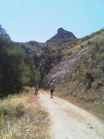 s de longitud. s de longitud.Ya inmersos en la subida debemos de seguir el camino hasta que este desaparece y se convierte en un reducido sendero, es aqui justo, donde se bifurca el camino de la siguiente manera: 1) Seguir recto nos lleva hacia Los Tajos de Almorchon, donde podremos tener la ocasion de divisar el vuelo de los buitres a distancias realmente cercanas (mas de lo que pensais), y asomarnos al precipicio del tajo que en su maximo apogeo llega a 300 metros de caida; veremos la Garganta del Chorro por su zona norte, divisando al fondo el Desfiladero de los Gaitanes y por supuesto buena parte del Caminito del Rey. ˇˇOJO con el vértigo!!. Debemos de deshacer el camino (solo 150 m. aprox.) para regresar al cruce anterior. 2) Seguir a la derecha por un sendero seńalizado con 2 piramides de piedras. Este nos obligará a ascender a traves de matorral espeso, que mas arriba se convierte en pinar, para finalizar en la cumbre de esta montańa fácil de distinguir desde la distancia por su singular y extrańa morfología. Una vez en la cumbre las vistas están servidas, A DISFRUTAR. EL CACHE está poco antes de coronar, cerca de una "ventana" en la piedra. De vuelta a la pista,podemos regresar por el camino de ida. Si queremos andar más, podremos girar a la derecha para seguir bajando y en 1 km. llegar a la central eléctrica; pasano ésta se ubica la entrada norte del Caminito del Rey, conocido internacionalmente. También tenemos curiosas placas que nos indican a la altura que llegó el agua en ese lugar hace ańos. De regreso a la central, nace un carril que baja a la derecha hacia el rio Guadalhorce. En 600 metros el carril da paso a una estrecha vereda ascendente. Al final de la subida tendremos unas vistas de la presa Guadalteba-Guadalhorce; el sendero finaliza en un tunel y éste en la carretera. Avanzando hacia la izquierda llegaremos al aparcamiento dando por finalizada la ruta. |
|
PICO DEL
CONVENTO
The route passes in
the Natural Place Park of Burn Them, it begins in the zone of the
reservoirs for despues it was entering in the Saw of the
Slate. The coordinates N 36 ş 55.798 ' W004 ş 48.039 ' they serve us like parking in the wings of the road (maximum 10 cars), though in the surroundings they find the zones of aquatic activities where there is great quantity of parking. In this waypoint a hole is opened in the wall of a length of 150 m. Aprox., this one will be our beginning and end of route. Still inside him, our friend Charino has left a cache, Luck. Going out of the tunnel we join to a descending track, that we must leave several hundreds of meters hereinafter to join to an ascending rail that it is born for the right. Sign to have been wrong is to come to a tunnel of great height of approximately 50 meters of length. Already immersed in the raise we must follow the 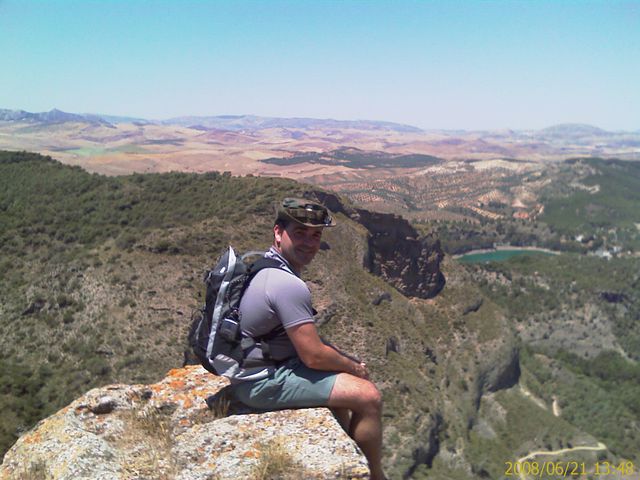 way until this
one disappears and turns into a limited path, it is here just,
where there bifurcates the way of the following
way: way until this
one disappears and turns into a limited path, it is here just,
where there bifurcates the way of the following
way:1) To be still rectum takes us towards Almorchon's Slits, where we will be able to have the occasion to spy the flight of the vultures to really nearby distances (more of what thinking), and to appear to the precipice of the slit that in his maximum height comes to 300 meters of fall; we will see the Throat of the Jet for his north zone, spying to the bottom the Gorge of the Gaitanes and certainly good part of the Caminito of the King. EYE with the dizziness!!. We must undo the way (only 150 m. Aprox.) to return to the previous crossing. 2) To continue to the right for a path put up signs with 2 pyramids of stones. East will force us to ascend across thick bushes, which mas above turns into pinegrove, to finish in the summit of this mountain easy to distinguish from the distance for his singular and strange morphology. Once in the summit the sights are served, TO ENJOYING. THE CACHE is small before crowning, near a "window" in the stone. Of return to the track, we can return for the way of going. If we want to walk more, we will be able to turn to the right to continue going down and in 1 km to come to the electric power station; pasano this one locates the north entry of the "Caminito del Rey", known internationally. Also we have curious plates that indicate us to the height that the water came in this place years ago. On returning to the head power station, there is born a rail that goes down to the right towards the river Guadalhorce. In 600 meters the rail gives step to a narrow ascending path. At the end of the raise we will have a few sights of the prey Guadalteba-Guadalhorce; the path finishes in a tunnel and this one in the road. Advancing towards the left side we will come to the parking giving for the route finished. |

 , al final me quedó doble mal sabor de boca, el primero por no encontrarlo, rebusqué por todos lados, pero nada, tal vez después de la sudada, a las 17:15 horas 32 şC, el cerebro y la vista no funcionan bien, y la segunda razón, ˇse me olvidó la cámara de fotos !
  , y es que, el pico es un mirador perfecto de toda la zona, con unas vistas inmejorables, hoy no era el día.