Master Index Nearest Caches PDE -11380- Tarifa by >fetiche< (2/1,5)
N36° 01.802 W5° 37.299 (WGS84) UTM 30S E 263781 N 3990460 Use waypoint: GC1N7J3 Size:  Regular Hidden on 1-3-2009 Regular Hidden on 1-3-2009
In Andalucía, Spain  (This cache may contain travel bugs) (This cache may contain travel bugs)
Traveling Princess (ref = TB14VJJ) Difficulty:  Terrain: Terrain: 
|
|
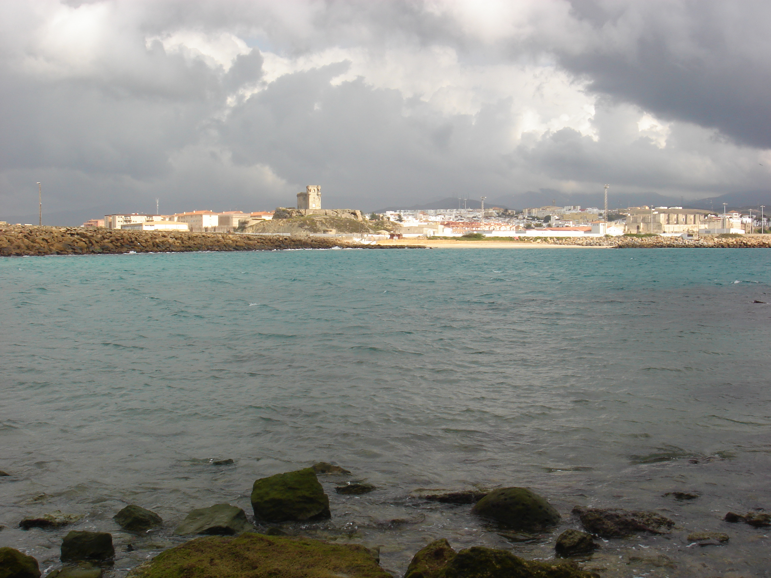
TARIFA - CÁDIZ
-
País
 Espańa
 -
Com. Autónoma
 Andalucía
 -
Provincia
 Cádiz
Cádiz -
Comarca Campo de Gibraltar
-
Partido judicial Algeciras
-
Población: 17.736 habitantes (censo 2008)
-
Superficie: 419 km˛.
-
Altitud: 7 metros sobre el nivel del mar.
-
Punto más alto del término municipal Tajo de las Escobas 840 m.
-
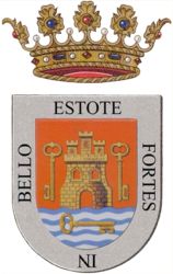
Escudo:
El municipio de Tarifa se sitúa en el extremo meridional de la Provincia de Cádiz, ocupando la parte occidental de la comarca del Campo de Gibraltar.
Dentro de su término municipal se encuentra el punto más meridional de la Península Ibérica, la Punta de Tarifa o Marroquí, accidente geográfico que se sitúa en la Isla de las Palomas, unida hoy a la propia ciudad por medio de una carretera-calle, que sirve de acceso al faro que en ella se ubica.
El cabo o Punta de Tarifa sirve además de divisoria a las aguas del Mar Mediterráneo y del Océano Atlántico, que se cruzan justo enfrente de la propia ciudad, que por lo tanto está situada en la parte más angosta del canal o Estrecho de Gibraltar, a una distancia máxima de 14 kilómetros de las costas marroquíes, lo que la convierte en la ciudad europea más cercana al continente africano.
Tarifa colinda al Este con los términos municipales de Algeciras y Los Barrios, al Norte con el término de Medina Sidonia, y al Noroeste con los de Vejer de la Frontera y Barbate. Los límites Oeste, Sur y Sudeste no son político-administrativos sino físicos, así al Oeste limita con el Océano Atlántico y al sur y Sudeste con el Mar Mediterráneo.
Debido a la gran extensión del municipio, en Tarifa se encuentran otros núcleos poblacionales o pedanías, entre ellas:
- Bolonia, junto a las ruinas de la antigua ciudad romana de Baelo Claudia.
- Facinas.
- Tahivilla.
- Atlanterra, junto a Zahara de los Atunes, en el límite con el término municipal de Barbate.
En Tarifa se encuentra más de medio centenar de cuevas y abrigos con arte rupestre, pertenecientes al conjunto conocido localmente como arte sureńo. De todos estos yacimientos destaca la Cueva del Moro con grabados de caballos de una antigüedad de 20.000 ańos.
Datos sacados de www.wikipedia.org
Hay que dar un paseo de 20 minutos. No fiarse de lo que veis en google earth.
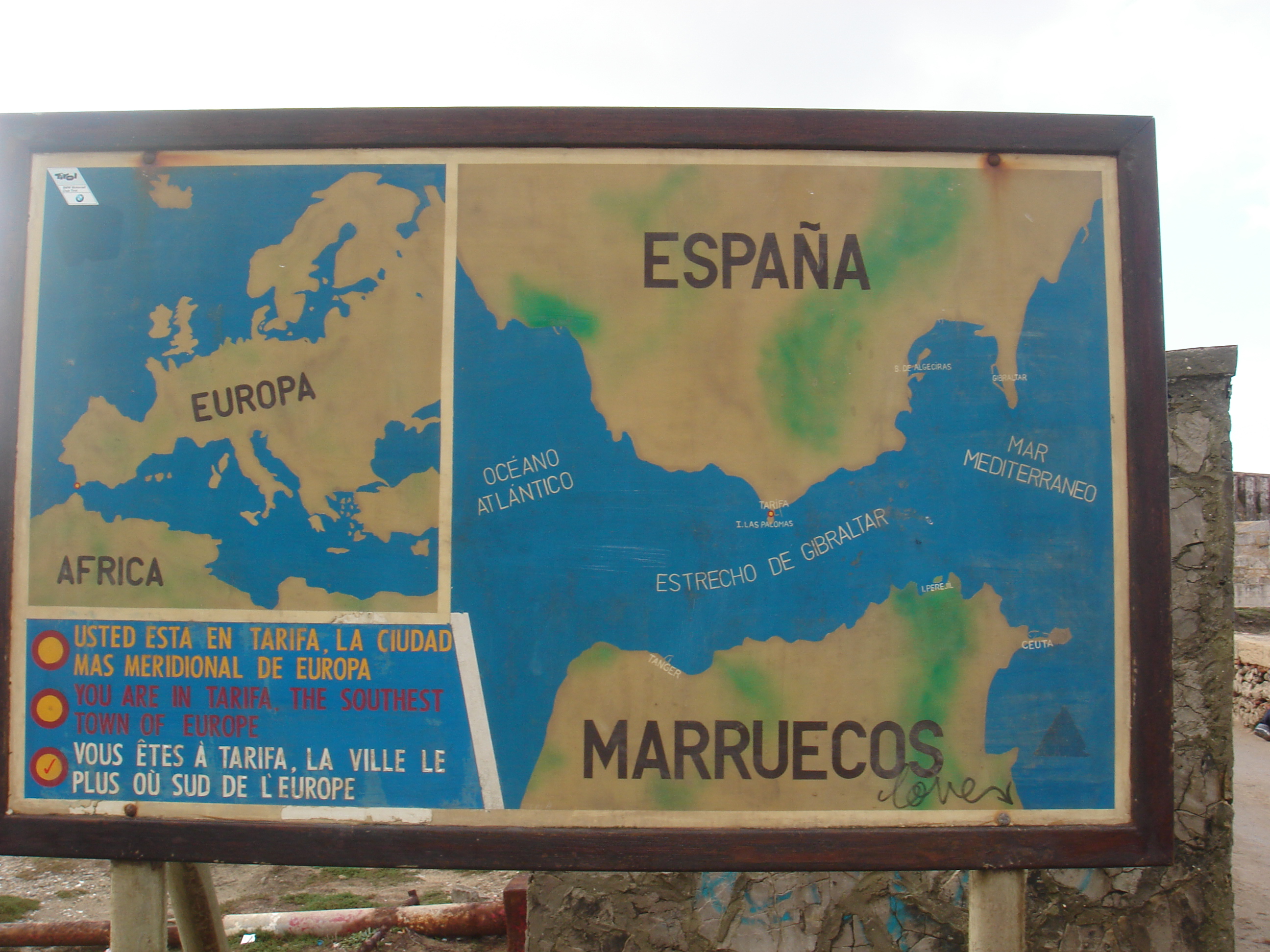
Tarifa is a small town on the southernmost coast of Spain. It is part of the province of Cádiz, which, in turn, is part of the Andalusia region. The town is located on the Costa de la Luz ("coast of light") and across the Straits of Gibraltar from Morocco, from which the lights of Tarifa are visible at night. The municipality includes Punta de Tarifa, the southernmost point in continental Europe. There are five smaller villages who depend economically on Tarifa. They are Tahivilla, Facinas, Bolonia and Zahara de los Atunes.
There are regular ferries between Tarifa and Tangier and bus services between Tarifa and Algeciras, about 20 km to the northeast, and Seville about 200km to the north.
Tarifa is well known for its buzzing social scene during the days of summer. It provides a small-town friendly atmosphere, with many activities for children, while also offering exciting activities for adults at night. In recent years it has become a popular spot for northern-Europeans to spend their summers.
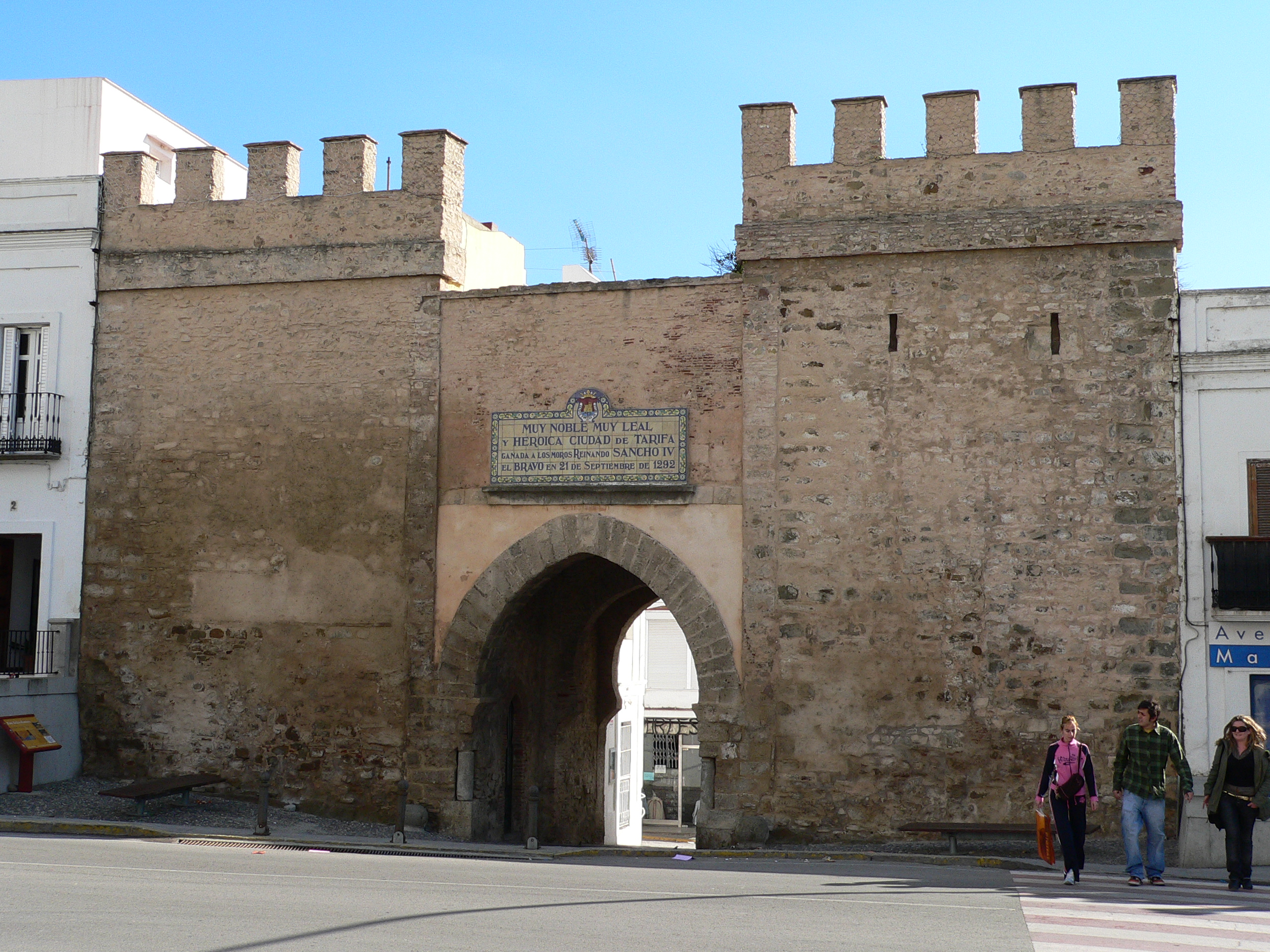
Near the port of Tarifa there is a well-preserved castle, the Castillo de Guzman. The coast of Tarifa is also popular with windsurfers and kitesurfers due to the strong winds of the straits. For this reason Tarifa is also dotted with hundreds of wind turbines. Tarifa is an excellent place to watch migrating birds, in particular the storks which cross the Straits of Gibraltar in spring and autumn. Also whale and dolphin watching can be done on the 14 kilometer wide Straits. Like the name Costa de la Luz suggests, Tarifa enjoys many hours of sunlight each year.
Tarifa is sometimes credited with being the origin of the word, tariff, since it was the first port in history to charge merchants for the use of its docks, but other sources point to the Arabic word, ta'rďf, as the origin. The name "Tarifa" itself is derived from the name of the Berber warrior, Tarif ibn Malik.
Data from www.wikipedia.org
need walk for 20 minutes. Do not rely on google earth
Additional Waypoints
P21N7J3 - Parking 2N 36° 01.308 W 005° 36.917
N36 01.308 W5 36.917
PK1N7J3 - Parking 1
N 36° 01.448 W 005° 36.993
N36 01.448 W5 36.993
Additional Waypoints (2)
| Code | Name | Type | Links | Comments | Date | Coordinates | Distance |
| P21N7J3 | Parking 2 | Parking Area | Google Maps | N36 01.308 W5 36.917 | 1-3-2009 | N 36° 01.308 W 5° 36.917 | 1,08 kms SE |
| PK1N7J3 | Parking 1 | Parking Area | Google Maps | N36 01.448 W5 36.993 | 1-3-2009 | N 36° 01.448 W 5° 36.993 | 0,80 kms SE |
Additional Hints (There are no hints for this cache)
Current at 30-6-2009
![]() 17-6-2009 by coopr
17-6-2009 by coopr
Thanks for cache. Little bit windy place but nice. We wanna go back there from Czech rep right now, but we have to go back to work, wtf...:)
![]() 16-6-2009 by flotron84
16-6-2009 by flotron84
This cache finalised our short visit to the beautiful town of Tarifa. The wind wasn't blowing so hard today so there were no Kite Surfers out. Spotted the cache with ease, but we had to wait for muggles to pass.
Thanks for the walk and the cache.
Dropped off 4musketeers Cardinal Geocoin and the Travelling Princess
![]() 8-6-2009 by Xma62
8-6-2009 by Xma62
Next stop on our Spain-'Cache-Trip together with Elora Dana. Nice place. TFTC
![]() 8-6-2009 by Elora Dana
8-6-2009 by Elora Dana
At a little trip around Tarifa together with Xema62, Tona and Xenoron we found this nice cache place. The view was very nice and we saw many kite surfers at the large beach.
TFTC
![]() 30-5-2009 by legomission
30-5-2009 by legomission
nice walk
tftc
Nearby Caches
GC1KX1F Tarifa Kite-Surf (4,79 kms NW)
GCH43E
GCQDE0 Tajo de las Escobas (10,39 kms NE)
GC14A8Z Lenguaventura #1# (11,14 kms NW)
GCT4Z8 Camino de los Prisioneros (13,22 kms NE)
Additional Hints (There are no hints for this cache)